
-
Country-wide rainfall
-
Second April system
-
45 days left – For what?

Pakistan had witnessed very active weather since April 10 which is likely to continue, something that is not much seen in April and was missing since this winter season. A fresh Western Disturbance “02” is likely to grip the country after 48 to 72 hours that is very likely to cause countrywide rainfall stretching from Karachi till Siachen. Precipitation of varying intensity with fast/strong winds (46 km/h 70 km/h) is expected in the country. A update will be issued whenever necessary.
Winter 2011 – 2012: Quiet and relaxed!
The current winter season was much quiet in the country as no widespread rainfall occurred in the country apart from few isolated events. However a total of 29 western disturbance affected parts of the country though none of them covered the whole country as they used to do in the past.
But April started with a boom and a bang, the first Western Disturbance of summer season, which PWP named as “01” reached the country on April 9 and remained so till April 14. Rainfall occurred in Islamabad on April 8, heavy rainfall in Murree on April 14. While unusual light hailstorm occurred in the southern city of Hyderabad on April 12. Drizzle occurred in Lahore on April 13.
Western Disturbance 02: Something new!
“Warning: Western disturbance has the potential to create severe weather conditions along the Oman and Makran coast. Sea conditions are likely to be rough along Makran coast.”
Timeline of this system

Western Disturbance 02 would reach western-central parts of the country on April 19. But due to the humid air, moisture incursion and the upper low, strong thunderstorm would form over northern Oman that might affect southern Pakistan. Following is the timeline of the western disturbance as well as the coastal thunderstorm (a part of WD 02);
- On April 17 mid-day this formation would be visible over upper Oman, few scatter clouds would be visible along the western Makran coast. On early April 19, they would move slight East in the Arabian sea and intensify further over the warm waters by that time thunderclouds would start to form over the Makran coast that would have the potential to bring rainfall. The main thunderstorm would keep moving east and would finally dissipate near the Sindh coast on April 21.
- Western Disturbance 02 would enter the western-central Pakistan on April 19 and persist till four to five days, it would start its influence over the Kashmir from April 20.
Stray thunderstorms/clouds would keep on forming over the different parts of Pakistan till one week. Fresh western disturbance 03 would also affect the northern areas of the country soon, once again highlighting that its going to be a very busy days for the skies of Pakistan.
International Weather for Oman and India
Severe thunderstorms could batter the northern parts of Oman including the capital Muscat, which had seen some thunder activity since past few week, from April 18 till April 20. Clouds that have been forming over southern Oman were stretching till the western coast of India, that is still visible.
With the entrance of western disturbance 02, thunderclouds could form over the western provinces of India that is Gujarat and Rajasthan with dust-laden winds.
Effects on Pakistan

Scattered precipitation is expected in Azad Kashmir, Balochistan, Khyber, Punjab, Gilgit and Sindh in next few days. Rainfall in the northern areas would exceed 30 mm. Following is the province forecast of few areas;
Islamabad
Drizzle/isolated shower is expected in Islamabad throughout this week. From April 19 night till 2 to 3 days, Islamabad could experience moderate rainfall with thunder/lightening along with strong winds (56 km/h or greater).
Punjab
There are also chances of rainfall in many cities of Punjab which includes Lahore, Multan, Faisalabad and other surrounding cities. Rainfall along with period of hail could occur over the plains of Punjab. Throughout his week many cities of Punjab would witness cloudy intervals.
Balochistan
There are chances of heavy rainfall with fast winds (46 km/h) along the Makran coast especially the western parts including Gwadar on April 18 and April 19.
Sindh

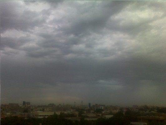
Some parts of Sindh province would witness cloudy intervals on April 19 and April 20, there are chances of drizzle/isolated shower in Sukkur, Larkana and Nawabshah on these days as well.
There are chances of light rainfall in Hyderabad and Jamshoro during that period as well. (Image given by PWP reader Waseem Ahmed)
Siachen Tragedy – More severe weather ahead?
Cloud cover has remained over the area since past few days, with the advancement of western disturbance 02, dense cloud cover is expected over Siachen while there are chances of showers/snowfall from April 21 with gusty winds (80 km/h).
Karachi – All praying for Rain…Again!
Some people would say that why is Karachi’s forecast under a new heading, shouldn’t it be in the Sindh section, Well there are two things special for Karachi this time, those are;
- This could be the first April rainfall since 1997.
- Thunderstorm forming such south (by a western disturbance) of Pakistan since 2006.
- 1997, 4 mm
- 1988,
- 1983, traces
- 1982
- 1981
- 1970
- 1965
What is going to happen on this Thursday and Friday
Due to the weakening of the thunderstorm, there are chances of scattered light rainfall with fast winds in the city on April 19 and April 20, GFS shows rainfall to remain under 10 mm while CFS shows 2 mm, however none has shown it to rise beyond 15 mm. Better enjoy this April rain!
Update issued on April 18 at 10:00 pm PKT
“Forecast of PWP remains almost same”

Western Disturbance ’02’ has entered west-central Pakistan, a day earlier than expected, showers occurred at many places of the country due to which parts of Balochistan including Quetta are expected to get showers at times moderate with fast winds till next few days, traces of rain also occurred at Makran coast. There are chances of isolated heavy rainfall with fast winds along the coast of Makran especially the western part as forecasted on April 16, while light showers also expected in various parts of Sindh including Karachi, Hyderabad, Jamshoro and other surrounding areas. This week the total rainfall at isolated places in southern-western Khyber province could (10%) exceed beyond 70 mm – 95 mm, as heavy downpour with strong winds (56 km/h) is expected from April 19 night/April 20. Rainfall is also expected in Islamabad and cities of Punjab including Lahore and Multan during this period. Following was the recorded rainfall that occurred today;
- Balochistan
- Barkhan got 50 mm
- Quetta got 30 mm
- Punjab
- Bahawalpur got 48 mm
- Multan got 6 mm
Moderate rainfall also occurred in Muscat, Oman (Picture at the top is from Oman). Sea conditions in Oman especially the northern sector of the sea has been rough. Maximum wave height reached 1.3 metres, could reach 2 metres. More thundershowers with fresh winds expected in Oman including Muscat till 24 hours to 48 hours and then a stable weather would prevail. Following is the rainfall that occurred in Oman (station);
- Um zamaim got 108 mm.
- Ras Al Hadd got 98 mm.
Update on April 19 at 8:30 pm PKT – NEW
“Coastal thunderstorm becomes unimportant”

The coastal thunderstorm that was expected to intensify further on April 19 has failed to do so due to which mostly light rainfall with fast winds occurred along the Makran coast during the last 24 hours. Due to the weakening phase, more drizzle/light rainfall could occur in Makran coast till 12 hours while the forecast of Sindh coast including Karachi has been same since April 15, that is drizzle/light shower is expected till April 20 mid-day, rain also occurred today in the city, the coastal storm would be completely dissipated by April 21 early morning. Sea conditions would be stable after 6 to 12 hours. Western Disturbance “02” likely to cause rainfall/hailstorm in northern Pakistan with few isolated heavy falls after 12 hours including Islamabad, Peshawar, Quetta. Following is the rainfall recorded in Balochistan;
- Ziarat got 24 mm.
- Zhob got 21 mm.
- Quetta got 19 mm.
- Kalat got 9 mm.
- Sibi got 9 mm.
- Lasbela got 8 mm.
- No significant rainfall occurred at Makran coast
Though the same thunderstorm caused heavy rainfall with strong winds in northern Oman on April 17 and April 18. On April 19, the storm was expected to move away from Oman and it has done so as forecasted by PWP due to which stable weather prevails over the sultanate. Following is the rainfall recorded at few stations of Oman;
- Muscat got 12 mm.
- Ibra got 34 mm.
- Bidiya got 36 mm.
- Sur got 10 mm.
Stay tune for more developing story!
