
-
Bear the Heatwave for some days
-
Road to Monsoon starts!
-
Pre-Monsoon activity in Pakistan?
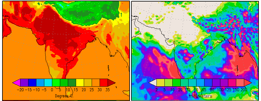
The extreme heatwave that started from May 15, it weakened during the last weekend of May due to western trough ’08’ that brought severe hailstorm to the province of Khyber Pakhtunkhwa including Peshawar. Once again the heatwave is intensifying and it will continue to do so till the expected Pre-monsoon activity in the country.
The highest temperature would be recorded from the the coming week that is June 2 till June 8 after that a slight decrease of 1°C to 3°C expected though the mercury will still be high till the mid-week of June.
Cool North not so cool!
Mostly dry weather is expected in the northern half of the country, few high and mid level clouds can pass through the extreme northern areas of the country from time to time.
Temperatures will once again rise in these areas as the cold fronts are not near the northern parts. The highest temperature can reach north-eastern Punjab (45°C/47°C in Lahore, Sialkot, Jhelum, Gujranwala and adjoining cities), while 41°C/44°C in the northern areas Islamabad, Peshawar and adjoining cities. It can reach 47°C/49°C in Faisalabad, Okara, Sahiwal and adjoining cities.
Central Areas to roast again!
Temperature of 44°C/47 °C can reach in Multan, Muzaffargarh, Bahawalpur and adjoining cities.
South to sweat badly as heatwave gains peak!
Sukkur, Jacoababad, Larakana and other adjoining cities can experience 46°C/50°C while 45°C/48°C in Nawabshah, Dadu and adjoining cities. Hyderabad, Mirpur Khas and adjoining cities can experience 40°C/43°C
Nothing is changed for Karachi’s temperature as it could remain around 32°C/36°C during the next coming days with fast winds, partly cloudy weather can also occur.
2013 Monsoon News
![]()
-
Monsoon hits Kerala!
-
Active Monsoon in June
-
Pre-Monsoon around the corner in Pak?
Factors – Outlook
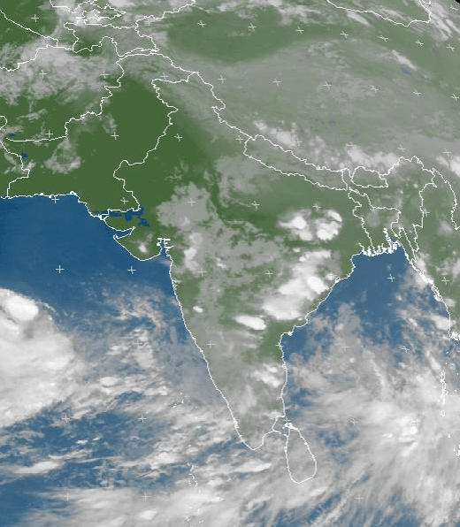
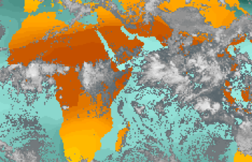
*A upper air cyclonic circulation is over Chhattisgarh and adjoining states of India. It was the depression BOB 02 that affected West Bengal of India few days back.
Monsoon in all important Kerala!

Active Monsoon is expected in the month of June, Monsoon hit Andaman sea on May 17 while it hits Kerala on June 1. Indian Meteorological Department (IMD) did say that Monsoon might hit Kerala on June 3 but PWP in its Monsoon III did say that it would hit early than June 3.
Temperatures are decreasing in central India due to the depression BOB 02 which has moved inland as an UAC. Monsoon will now move into Karnataka, Andhra Pradesh and other parts of Tamil Nadu. Monsoon still has to move towards central India and then westwards. There are slim chances of tropical activity in the Arabian sea in the month of June.
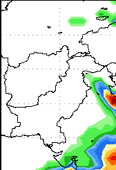
Pre-Monsoon can break the Pak heat!
Scattered pre-monsoon can occur in Sindh and North-eastern areas of Punjab from the middle week of June. Surrounding areas of South Punjab can also be affected depending upon the track of monsoons circulation.
Poll of the Week
Pakistan Weather Portal (PWP) wants to know;
